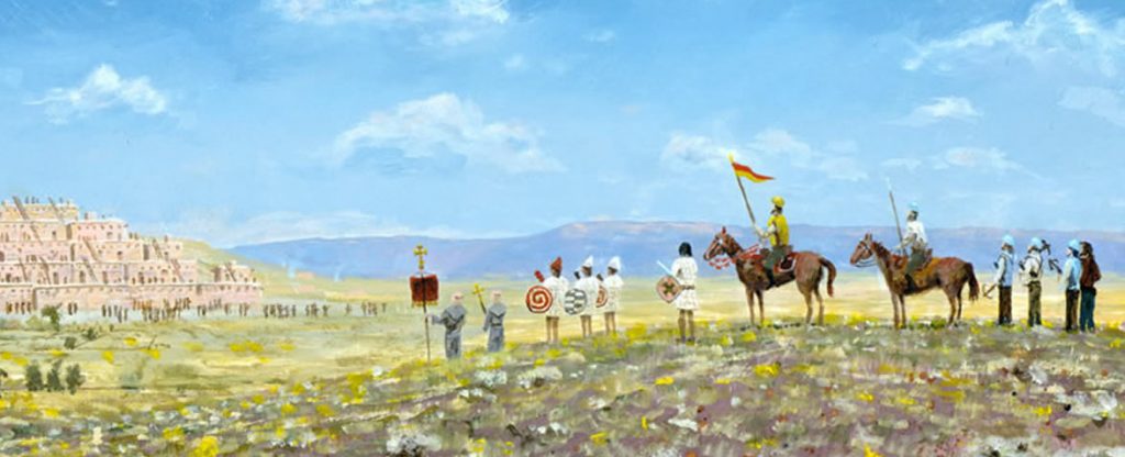
In my previous post I discussed the passage of Cabeza de Vaca, Marcos de Niza and Melchor Díaz, now let’s examine the passage of the main body of the expedition.
Itinerery
Coronado left the Valley of Hearts on or around May 31 (arrived on May 26, rested 4 days) and travelled the 80 leagues to Chichilticalli in 20 days, that means he averaged about 13.8 miles per day on this stretch. They rested for 2 days at Chichilticalli and began to cross the great despoblado on June 23, they crossed the Rio San Juan on Saint John’s Day June 24 and arrived at Cibola on July 7. On this last leg they made better time even though the terrain was rougher, 15.8 miles per day.
- Arrive Valley of Hearts: May 26
- Rested 4 days
- Depart Valley of Hearts: May 31
- Arrive Chichilticalli: June 20
- Rested 2 days
- Depart Chichilticalli: June 23
- Crossed San Juan: San Juan Day (June 24)
- Arrive Cibola: July 7
- Culiacan to Chichilticalli – 220 leagues
- Chichilticalli to Cibola – 70 leagues
- Culiacan to Cibola – 350 leagues
- Culiacan to Hearts – 150 leagues
- Corozones to Cibola – 150 leagues
- Chichilticalli to Hearts – 80 leagues
- Chichilticalli to Cibola – 70 leagues
- Chichilticalli to Culiacon – 230 leagues
Juan Jaramillo
The trip between the Valley of Hearts and Chichilticalli doesn’t get much description except by Jaramillo who wrote twenty years later and can be proved to be wrong in several points, which brings into question everything else. Yet he did travel with Coronado’s advance party. Let’s first get an overview of his route.
About two days were spent in this village of the Hearts. (He is wrong here, Coronado, who wrote his just days afterword tells us they spent 4 days in the Hearts)… We went on from here, passing through a sort of gateway, to another valley very near this stream, which opens off from this same stream, which is called Señora… There are mountains on both sides of them, which are not very fertile. From here we went along near this said stream, crossing it where it makes a bend, to another Indian settlement called Ispa… From here we went through deserted country for about four days to another river, which we heard called Nexpa, where some poor Indians came out to see the general, with presents of little value, with some stalks of roasted maguey and pitahayas. We went down this stream two days, and then left the stream, going toward the right to the foot of the mountain chain in two days’ journey, where we heard news of what is called Chichiltic Calli. Crossing the mountains, we came to a deep and reedy river, where we found water and forage for the horses. From this river back at Nexpa, as I have said, it seems to me that the direction was nearly northeast. From here, I believe that we went in the same direction for three days to a river which we called Saint John (San Juan), because we reached it on his day.
Jaramillo, writing 20 years after the expedition, is probably correct in the general features of the land and their order, but he is wrong in the number of days in two places just within this short passage and his directions of travel are easily shown to be wrong in later parts of the trip where travel was between known points on today’s map. So however descriptive this may seem we need to take his days and directions of travel with a few grains of salt.
In the previous post I established that they were following a trail that, at this point, was well established, it had already been traveled by Cabeza de Vaca, Marcos de Niza and Melchor Diaz. This trail led to the headwaters of the Yaqui River, topping out somewhere south of the San Bernadino Ranch. It’s interesting to note that Jaramillo mentions only one river being followed between Hearts and Ispa, but Casteneda mentions another Suya, which I believe corresponds to the highly populated region mentioned by Diaz, it is this Suya Valley that I believe to be a tributary of the Upper Yaqui, probably the Bavispe. According to Jaramillo’s account, Ispa is the last village along this valley before making the four day crossing to the Nexpa, they arrived at Ispa by crossing the river “where it makes a bend”. There is no doubt that the village of Ispa is at or near the headwaters of whatever stream they were following, what a coincidence then that the Bavispe River makes a huge bend at it’s most northern extent so that anybody following this stream north along its eastern bank would have to cross at the bend to continue north. This would put it somewhere in the general vicinity of Fronteras Sonora. If they had followed the Sonora River, as is often assumed, they would have followed it until it petered out or ceased being a stream (especially in June when they followed it), but Jaramillo does not record following it to its terminus but instead crossing it where it makes a bend, obviously it was still a stream at this point but was no longer traveling in the direction they were going. Only the tributaries of the Yaqui would provide this scenario, the Rio Bavispe, the Rio Fronteras and the Rio Cajon Bonito all turn back on themselves in this region.
From Ispa they traveled four days in a nameless direction over unidentifiable country, although we can assume that the general direction would remain towards that of Cibola. In figuring out where they went from here we need to look for the north flowing stream they followed after these four days. From the most northern extent of the Yaqui drainage near Fronteras Sonora there are three valleys they could have walked to in four days travel, the Sulphur Springs Valley, the San Simon Valley or the Animas Valley. The Sulphur Springs Valley does not have a north flowing stream, or at least not one that would contain any water in June. The San Simon Valley has a good stream and the Animas does in places, so either of these are possible. I favor the San Simon because it has a more reliable stream, was used historically as a north-south corridor and is a more direct route between the Bavispe and the Gila. One thing to remember about cross country travel in these days is that the route does not always follow the most logical route as would plot it today. Travel was very direct and oriented towards water supplies, it was often more economical to go over a mountain then spend days going around and they needed a water supply every so often. So while a modern road might take off from Tombstone Arizona and head across Government Draw Pass towards Elfrida Arizona in a straight line, looking at historical records shows us that although Government Draw Pass is the most direct route between the San Pedro and Sulpher Springs Valleys, parties generally favored Middlemarch Pass or South Pass for their dependable water supplies. With this fact in mind, think of Coronado’s expedition traveling from the area of Fronteras Sonora to near Rodeo New Mexico where the San Simon River begins, they probably didn’t follow the flat valley bottom as the modern highway does, but the edge of the Chiricahuas or Peloncillo Mountains where there would be springs.
After following the Nexpa north for two days they would have reached the village where Marcos de Niza stayed before crossing the lesser despoblado, (De Niza tells us it is four days from this village to the next settlement which must be Chichilticalli), if the San Simon River is the Nexpa as I surmise then this village is likely in the area of San Simon Cienega which has a long history of habitation. From here they leave this stream to travel to the right for two days to the foot of the mountain chain. There isn’t much description of this next stretch either but we can surmise that it was fairly bleak for two reasons. There is a pattern to the land of Northern Sonora and Southern Arizona, traveling from south to north almost anyplace in this area you would follow south flowing streams until you could follow them no more, then you would cross the plains at the crest of this unnamed divide and reach a north flowing stream of the Gila watershed, continuing north to the Gila the land would lose elevation crossing a rather bleak desert in the days before reaching the Gila where the high mountains would begin and have to be crossed to reach Zuni. That pattern would be the same if you followed the Sonora crossing to the San Pedro River or followed the Bavispe crossing to the San Simon River or any other combination you could come up with. What I am saying is first, that Jaramillos general pattern rings true and could fit in many places, and second that these final days before reaching the Gila (San Juan) would be dry and grass would be scarce no matter where you put it. The other reason we know that grass and water were scarce on this stretch is that once crossing the mountains he mentions that they found grass and water for the horses, the only time he mentions such a thing, it was noteworthy because they had just made a long crossing without adequate grass and water. This was possibly the reason that the indians in the last village (San Simon Cienega) wanted Marcos de Niza to rest up before leaving from there, because there was a long, waterless stretch ahead.
Jaramillo next mentions Chichilticalli in such a passing way that it appears we are supposed to know what he is talking about “to the foot of the mountain chain in two days’ journey, where we heard news of what is called Chichiltic Calli”, the reason, I believe, is that he had given other details in the beginning of his account, where he wrote the following.
He went with the said horsemen to explore the route and prepare the way for those who were to follow. He pursued this direction, though with some twisting, until we crossed a mountain chain, where they knew about New Spain, more than 300 leagues distant. To this pass we gave the name of Chichilte Calli, because we learned that this was what it was called, from some Indians whom we left behind.
Here, at the beginning of his narrative he defines Chichilticalli as a mountain pass, so when he mentions later that they went to the foot of the mountains where they heard news of Chichilticalli or as the Flints translated it, “we went to the right to the foot of the mountains in two days of journey, where we had knowledge that it was called Chichiltiecally” which makes even more sense. He was not talking about a ruin here, he is talking about the mountains and more specifically the pass through those mountains. The other point to take away from this is that Coronado did not camp here, on this southwest side of the mountains as is sometimes assumed, where Jaramillo first mentions the name Chichilticalli, they camped on the other side of the mountains where, according to Jaramillo, “Crossing the mountains, we came to a deep and reedy river, where we found water and forage for the horses”. If Chichilticalli were the name of the whole mountain chain, then it would be accurate for Coronado to report that he “rested for two days at Chichilticale” if they stopped in a valley on the other (northeast side) of this mountain chain, at this deep and reedy river or according to the Flints “deep, high-banked arroyo” where there was the all important grass and water for the horses.
Here again I need to point out two more of Jaramillos mistakes. He tells us that it is two days from the Nexpa to the foot of the mountains, then tells us they crosses the mountains but doesn’t tell us how long it took in total, but definitely leads us to think it may be two days travel from Nexpa to Chichilticalli, while Marcos de Niza, writing without the burden of twenty years of forgetfulness, tells us that it is four days from Nexpa to Chichilticalli. Then Jaramillo tells us that from the deep and reedy river (Chichilticalli camp) they traveled three days to a river they called the San Juan because they crossed it on his day. Yet Coronado and Casteneda tell us that Chichilticalli is on the border of the great depoblado and that it is fifteen days across the despoblado to Cibola, we know that they reached Cibola on July 7 and entered the great despoblado on Saint John’s Eve, so they must have left Chichilticalli on June 23rd and traveled one day between there and the San Juan River.
So this brings us up to Chichilticalli in Jaramillo’s narrative, but what do the other chroniclers say of this part of the journey?
Francisco Vázquez de Coronado
Coronado covers this journey with much less detail and much less error. He writes.
I set out from the Hearts and kept near the seacoast as well as I could judge, but in fact I found myself continually farther off, so that when I reached Chichilticale I found that I was fifteen days’ journey distant from the sea, although the father provincial had said that it was only 5 leagues distant and that he had seen it. We all became very distrustful, and felt great anxiety and dismay to see that everything was the reverse of what he had told Your Lordship. The Indians of Chichilticale say that when they go to the sea for fish, or for anything else that they need, they go across the country, and that it takes them ten days; and this information which I have received from the Indians appears to me to be true. The sea turns toward the west directly opposite the Hearts for 10 or 12 leagues, where I learned that the ships of Your Lordship had been seen, which had gone in search of the port of Chichilticale, which the father said was on the thirty-fifth degree… I rested for two days at Chichilticale, and there was good reason for staying longer, because we found that the horses were becoming so tired; but there was no chance to rest longer, because the food was giving out. I entered the borders of the wilderness region on Saint John’s eve, and, for a change from our past labors, we found no grass during the first days, but a worse way through mountains and more dangerous passages than we had experienced previously. The horses were so tired that they were not equal to it, so that in this last desert we lost more horses than before; and some Indian allies and a Spaniard called Spinosa, besides two negroes, died from eating some herbs because the food had given out.
The first statement is only partially true, he did intend to stay near the seacoast, they had thought that the coast was much closer to their route, but he followed the same route as that laid out beforehand by Estiban, Marcos de Niza and Diaz, so he was not actively trying to stay near the seacoast as he implies here.
However lacking this is in any details that would allow someone to follow his route, there are a few important details to note. The first is that he rested here for two days because the horses were becoming tired out, this associates the Chichilticalli campsite with the deep and reedy river on the other side of Chichilticalli Pass that Jaramillo tells us had grass and water for the horses. The second is that the great despoblado appears from this account to begin immediately following Chichilticalli, which they entered on Saint John’s Eve or June 23rd. The third piece of information here is that the despoblado is rugged, mountainous country for he says “we found no grass during the first days, but a worse way through mountains and more dangerous passages than we had experienced previously”. Finally there are indians living at or near Chichilticalli, as he mentions the “indians of Chichilticalli”.
Pedro Casteneda
Casteneda does not cross with Coronado’s advanced company as does Jaramillo, but travels with the main army several months later. However he does compile a lot of information into his account about the advanced party. He says.
The general and his force crossed the country without trouble, as they found everything peaceful, because the Indians knew Friar Marcos and some of the others who had been with Melchior Diaz when he went with Juan de Saldivar to investigate. After the general had crossed the inhabited region and came to Chichilticalli, where the wilderness begins, and saw nothing favorable, he could not help feeling somewhat downhearted, for, although the reports were very fine about what there was ahead, there was nobody who had seen it except the Indians who went with the negro, and these had already been caught in some lies. Besides all this, he was much affected by seeing that the fame of Chichilticalli was summed up in one tumble-down house without any roof, although it appeared to have been a strong place at some former time when it was inhabited, and it was very plain that it had been built by a civilized and warlike race of strangers who had come from a distance. This building was made of red earth. From here they went on through the wilderness, and in fifteen days came to a river about eight leagues from Cibola, which they called Red River, because its waters were muddy and reddish. In this river they found mullets like those of Spain. The first Indians from that country were seen here — two of them, who ran away to give the news.
This verifies my earlier assertion that they followed the same route established by others as “the Indians knew Friar Marcos and some of the others who had been with Melchior Diaz”. This also establishes that the wilderness (great despoblado) is immediately adjacent to Chichilticalli when he reports “Chichilticalli, where the wilderness begins”.
This is the first report we have of a ruin being located at Chichilticalli, Jaramillo associates that name with pass and mountain range while Coronado uses it without any explanation, Casteneda now tells us that a ruin is located here. We can also surmise that this soldier, who know something about fortifications, is right when he tells us that “it appeared to have been a strong place at some former time”, Chichilticalli ruin is no doubt located in a strategic location and not on flat land such as that seen at Kuykendall Ruin, 76 Ranch and some other suspected Chichilticali locations.
Next Casteneda tells of how the army, the group he traveled with, made the trip.
To relate how the army that was on its way to Cibola got on… they continued their march until they reached Chichilticalli. The men in the advance guard saw a flock of sheep one day after leaving this place. I myself saw and followed them. They had extremely large bodies and longwool; their horns were very thick and large, and when they run they throw back their heads and put their horns on the ridge of their back. They are used to the rough country, so that we could not catch them and had to leave them. Three days after we entered the wilderness we found a horn on the bank of a river that flows in the bottom of a very steep, deep gully, which the general had noticed and left there for his army to see, for it was six feet long and as thick at the base as a man’s thigh.
Very little information here except that the country around Chichilticalli is quite rugged and one day out from there they saw a herd of Bighorn Sheep which are usually only seen in very rough, mountainous country. The horn they saw is an interesting side note, it is believed by many to be the tusk of a long extinct mammoth, which also gives us another glimpse of the country they were traveling through because it was “on the bank of a river that flows in the bottom of a very steep, deep gully”.
Later in Casteneda’s report he goes into more detail about the Chichilticalli area, he writes.
Between Suya and Chichilticalli there are many sheep & mountain goats with very large bodies and horns. Some Spaniards declare that they have seen flocks of more than a hundred together, which ran so fast that they disappeared very quickly. At Chichilticalli the country changes its character again and the spiky vegetation ceases. The reason is that the gulf reaches as far up as this place, and the mountain chain changes its direction at the same time that the coast does. Here they had to cross and pass through the mountains in order to get into the level country. Chichilticalli is so called because the friars found a house at this place which was formerly inhabited by people who separated from Cibola. It was made of colored or reddish earth. The house was large and appeared to have been a fortress. It must have been destroyed by the people of the district, who are the most barbarous people that have yet been seen. They live in separate cabins and not in settlements. They live by hunting. The rest of the country is all wilderness, covered with pine forests. There are great quantities of the pine nuts. The pines are two or three times as high as a man before they send out branches. There is a sort of oak with sweet acorns, of which they make cakes like sugar plums with dried coriander seeds. It is very sweet, like sugar. Watercress grows in many springs, and there are rosebushes, and penny-royal, and wild marjoram. There are barbels and picones, like those of Spain, in the river of this wilderness. Gray lions and leopards were seen. The country rises continually from the beginning of the wilderness until Cibola is reached, which is 85 leagues, going north. From Culiacan to the edge of the wilderness the route had kept the north on the left hand.
Assuming that the Valley of Suya is the Bavispe Valley, it would make sense that they would see mountain Sheep between there and Chichilticalli near the Gila, the goats in question are probably Pronghorn Antelope naturally occurred in the grasslands of these high deserts and often formed vast herds of hundreds of animals. When Casteneda says the country changes character at Chichilticalli he is talking not about the Chichilticalli Mountains that they had to cross to get there, but referring to the vast (30 leagues wide) mountainous region that we have shown makes up the first part of this wilderness. Beyond these mountains lies the high plains of the Colorado Plateau, thus at Chichilticalli, the spiky vegetation (cactus, mesquite, etc) ceases as they leave the low desert behind. Here he again makes reference to the defensive position of the Chichilticalli ruins, “the house… appeared to have been a fortress”. He then describes the indians of Chichilticalli and seems to give a fairly accurate depiction of the Apaches. he next seems to indicate that Chichilticalli is not just adjacent to the mountainous high country, but completely surrounded by high country, perhaps in a mountain valley by saying that “The rest of the country is all wilderness, covered with pine forests”. Then he describes the White Mountains pretty accurately, describing the pinyon pines, ponderosa pines, the oaks and other vegetation and even mountain lions. He also says that the country rises continually from the beginning of the wilderness until Cibola, this ties in with other descriptions of this area indicating that rough mountains are crossed from the beginning of this wilderness for 30 leagues, it also indicates that the San Juan River at the beginning of this wilderness is the Gila, because only from there could the country rise continually. Finally, his directions are bad, as are Jaramillo’s. No doubt after twenty years their memories of directions of travel had been obscured because there is no possible way they could keep the north on the left hand from Culiacan, if that were the case they would have traveled across the middle of the Sierra Madre and Cibola would be located in the middle of the plains.
Melchor Diaz
The account of Melchor Diaz tells us a little about Chichilticalli’s position too, he writes.
I have given Your Lordship an account of what happened to me along the way; and seeing that it is impossible to cross the uninhabited region which stretches from hero to Cibola, on account of the heavy snows and the cold, I will give Your Lordship an account of what I have learned about Cibola… which I have ascertained by asking many persons who have been there fifteen and twenty years; and I have secured this in many different ways, taking some Indians together and others separately, and on comparison they all seem to agree in what they say. After crossing this large wilderness, there are seven places… There is a great abundance of wild goats, of the color of bay horses; there are many of these here where I am, and although I have asked the Indians if those are like these, they tell me no… I have not been able to learn more than what I have related, although, as I have said, I have had with me Indians who have lived there fifteen and twenty years.
Casteneda told us that the place Diaz stopped to wait out the snow was Chichilticalli, he said “They started and went as far as Chichilticalli, which is where the wilderness begins, 220 leagues from Culiacan, & there they turned back, not finding anything important”. So Chichilticalli is as far as he could go before the snow stopped him, which once again establishes that it is located near the Gila, near the White Mountains.
Matias de la Mota-Padilla
One other account exists with information about Chichilticalli. Matias de la Mota-Padilla lived in Guadalajara in the 1700s and wrote an account of the Coronado expedition based on now lost manuscripts. He said concerning Chichilticalli.
They went through a narrow defile (portezuela) which was named Chi-ehiltic-calli (which means red house “because there was a house there plastered on the outside with red earth, called almagre). There they found fir-trees with fir-cones full of good meat. On the top of a rock lay skulls of rams with large horns, and some said they had seen three or four of these sheep, which were very swift-footed
I find this particular, rarely quoted, piece of information intriguing especially when compared with the Flint’s translation of Jaramillo’s deep and reedy river as a “deep, high-banked arroyo”. Looking at these two accounts together gives me a whole new impression of what Chichilticalli is, it seems to be more than just a pass, it seems to be more than just a ruin, it seems to be a way through the mountains that passes through a narrow opening that leads to a grassy valley on the other side. In this pass exists a ruin in a defensive location, maybe it’s a cliff dwelling.
Rundown
Let’s rundown what we know about Chichilticalli from the above information.
- It is a pass through some mountains south of the Gila
- It is one to two days travel south of the Gila
- It is very close, possible surrounded on several sides, by high mountains with pine forests
- There is a pueblo ruin there, either in or very near the pass, made of red earth. Red soil has to be found in abundance very nearby.
- There is an expanse of low desert for probably two days of travel towards the southwest of these mountains
Not many places fit this description, certainly none of the current Chichilticalli candidates.
In my next post I will look at some of the possible locations for Chichilticalli.

Looking forward to your next post here Andy. I am a retired teacher and last taught Spanish. I used Coronado’s expedition to lure kids into Spanish history in the U.S. and also to teach about research. It worked like a charm. Currently I am taking Spanish classes and in each one I choose to research a new part of southwest Spanish history. I am familiar with the area of Arizona and New Mexico you talk about as my husband and I often go hiking out there. Can’t wait to hear where you think Chichilticalli might have been.
Barbara
Thanks for reading and for the comment. It has been awhile since I updated the site but I am back on this project so look for more updates soon.
Andy Ward
Do you have any more details on Melchior Diaz’ last expedition in which he died and perhaps could shed some light on the location of his grave? Thank you Andy!
Boy wouldn’t that be an exciting find! The grave of Melchor Diaz. Like finding a needle in a haystack though, it could be anywhere in Southern Arizona or Northern Sonora.
Im Thinking Its all wrong if its not the known Coronado Trail from Morenci AZ the Luna NM. You know where the burro Mts and chiricahau mts are, And Animas Mts? Mostly All in SW New Mexico. A Mimbres River that runs south yr around but peters out at Deming NM. and a day west to the San fransisco river or Gila.Known to have the Mimbres Culture associated with the early Casas Grandes. I think the Ruins of Piquime or Casas grandes was visited. They are adobe red. Other wise they was visiting yaquis in settlements here and there,ss well as Apache that are far gone today.I think the Expedition went a few days farther east than most like to think. The Legends say they came in at Douglas up to Safford by the Grahmn mts then over to Morenci, then up the Coronado Trail to Luna NM and Alpine AZ. And I believed that all my life till I read this account. Some say up the Santa Cruz? That would be possible but a stretch. Or the San Pedro but it would lead to far west. It is a known belief among archaeologists that the Ancient Hopi had ties with the Casas Grandes people ( piquime) cause there is the pottery in the Hopi ruins as well as the shells.. Also, I have been there twice to Piguime. And I was astounded at the amount of TONS yes TONS of sea shells that was there for the trade all over the ancient west. Surely to the Zunis and Hopis as well. But I was surprised when i learned all this shell came from the Sea of Cortez which would be about tens days walk if you knew the region. Certainly would be inhabited by natives and possibly abandoned to the Apaches. You mentioned the Yaquis and the Yaqui River near Pequime to the east. If they was any farther west, the only ruins possible would be Point of Pines. It has lots of Zuni pottery as well it being late enough to the 1400s. even though Archeaologists say ruins was certainly abandoned, There is always some hangers on. Whether native or Apaches. Its in the trees. Sheep, Antelope, high on the nantanes ridge which is the beginning to the Mogollon plateau . The account says they went to 2 days down Nexpa or San Simon to a Village. That would put them in Safford area. Then they went right for 2 days? That would put them in the San Carlos region which was always inhabited by Apaches. But then have to go Northeast to the natanes to point of pines ruins. Other wise I think the went up the Mimbres, over the Gila then the San Francisco rivers to Luna , down the little Colorado to Zuni. Cause there is this 2 days turning right and fits the description of the geography. And the Indians was just Apaches that lived in abandoned dwellings since they and their cousin Navajos was known to plunder and then inhabit their places. Probably the Mimbres ruins. And maybe there is not a real Chichilticalli Pueblo Dwelling like we like to think maybe? Chichilticalli, It sounds navajo anyway.
Well….Palawaptki? I know about this legend, that it was abandoned and was one of the major Hopi clans and it was mentioned somewhere in all this I thought. What is the deal with Palawaptki?
Niel